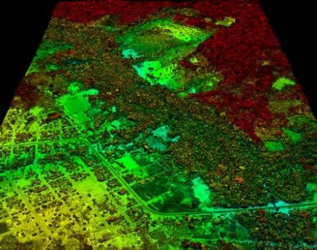
This image shows an area of road building and development adjacent to primary forest in red tones, and secondary forest regrowth in green tones. Credit: Carnegie Institution. You can see the effects of global warming in a new high-resolution map that shows carbon locked up in tropical forest vegetation and emitted by land-use practices in Peru’s Amazon. The maps were created with satellite mapping, airborne-laser technology, and ground-based plot surveys. And the images may help pave the way for a new United Nations monitoring system to curb deforestation and forest degradation…. Read the full story on TreeHugger

Continued here:
First-Ever Carbon Map Shows Global Warming in Peru’s Amazon


