Tag Archives: noaa

Governor Deal Expands State Of Emergency To 94 Georgia Counties In Preparation For Hurricane Irma

View post:

Source: Handout / Getty Press release from Governor’s Office: Following a recommendation from Georgia Emergency Management and Homeland Security Agency (GEMA/HS) officials ahead of Hurricane Irma’s imminent landfall, Gov. Nathan Deal today expanded the state of emergency to include a total of 94 counties. In light of the storm’s forecasted track shifting west, which will bring hurricane force winds, rain and potential flooding, 64 additional counties are now under the emergency declaration. Mandatory evacuations for coastal areas east of I-95 and all of Chatham County remain in place and contraflow on I-16 will begin at 8 a.m. Saturday. The additional counties include: Baker, Baldwin, Ben Hill, Berrien, Bibb, Bleckley, Brooks, Calhoun, Chattahoochee, Clay, Colquitt, Cook, Crawford, Crisp, Decatur, Dodge, Dooly, Dougherty, Early, Grady, Harris, Houston, Irwin, Jefferson, Johnson, Jones, Lamar, Lanier, Laurens, Lee, Lowndes, Macon, Marion, Meriwether, Miller, Mitchell, Monroe, Montgomery, Muscogee, Peach, Pike, Pulaski, Quitman, Randolph, Schley, Seminole, Stewart, Sumter, Talbot, Taylor, Telfair, Terrell, Thomas, Tift, Troup, Turner, Twiggs, Upson, Washington, Webster, Wheeler, Wilcox, Wilkinson and Worth Counties. A state of emergency now exists in the following 94 counties: Appling, Atkinson, Bacon, Baker, Baldwin, Ben Hill, Berrien, Bibb, Bleckley, Brantley, Brooks, Bryan, Bulloch, Burke, Calhoun, Camden, Candler, Charlton, Chatham, Chattahoochee, Clay, Clinch, Coffee, Colquitt, Cook, Crawford, Crisp, Decatur, Dodge, Dooly, Dougherty, Early, Echols, Effingham, Emanuel, Evans, Glynn, Grady, Harris, Houston, Irwin, Jeff Davis, Jefferson, Jenkins, Johnson, Jones, Lamar, Lanier, Laurens, Lee, Liberty, Long, Lowndes, Macon, Marion, McIntosh, Meriwether, Miller, Mitchell, Monroe, Montgomery, Muscogee, Peach, Pierce, Pike, Pulaski, Quitman, Randolph, Schley, Screven, Seminole, Stewart, Sumter, Talbot, Tattnall, Taylor, Telfair, Terrell, Thomas, Tift, Toombs, Treutlen, Troup, Turner, Twiggs, Upson, Ware, Washington, Wayne, Webster, Wheeler, Wilcox, Wilkinson and Worth Counties. The American Red Cross has three shelters open in Georgia. In Macon, East Macon Park and the North Macon Park Community Center are open. In Columbus, the Columbus Civic Center is open. In Augusta, Westside High School opens at 5 p.m. Friday, September 8. In Waycross, Waycross High School opens at 5 p.m. Friday, September 8. In Cordele, Blackshear Trail Elementary School opens at 6 p.m. Friday, September 8. In Dublin, Dublin High School opens at 7 a.m. Saturday, September 9. In Tifton, Abraham Baldwin College opens at 8 a.m. Saturday, September 9, and Leroy Rogers Recreation Center opens at 10 a.m. Saturday, September 9.  

Governor Deal Expands State Of Emergency To 94 Georgia Counties In Preparation For Hurricane Irma

Governor Deal Expands State Of Emergency To 94 Georgia Counties In Preparation For Hurricane Irma

View post:

Source: Handout / Getty Press release from Governor’s Office: Following a recommendation from Georgia Emergency Management and Homeland Security Agency (GEMA/HS) officials ahead of Hurricane Irma’s imminent landfall, Gov. Nathan Deal today expanded the state of emergency to include a total of 94 counties. In light of the storm’s forecasted track shifting west, which will bring hurricane force winds, rain and potential flooding, 64 additional counties are now under the emergency declaration. Mandatory evacuations for coastal areas east of I-95 and all of Chatham County remain in place and contraflow on I-16 will begin at 8 a.m. Saturday. The additional counties include: Baker, Baldwin, Ben Hill, Berrien, Bibb, Bleckley, Brooks, Calhoun, Chattahoochee, Clay, Colquitt, Cook, Crawford, Crisp, Decatur, Dodge, Dooly, Dougherty, Early, Grady, Harris, Houston, Irwin, Jefferson, Johnson, Jones, Lamar, Lanier, Laurens, Lee, Lowndes, Macon, Marion, Meriwether, Miller, Mitchell, Monroe, Montgomery, Muscogee, Peach, Pike, Pulaski, Quitman, Randolph, Schley, Seminole, Stewart, Sumter, Talbot, Taylor, Telfair, Terrell, Thomas, Tift, Troup, Turner, Twiggs, Upson, Washington, Webster, Wheeler, Wilcox, Wilkinson and Worth Counties. A state of emergency now exists in the following 94 counties: Appling, Atkinson, Bacon, Baker, Baldwin, Ben Hill, Berrien, Bibb, Bleckley, Brantley, Brooks, Bryan, Bulloch, Burke, Calhoun, Camden, Candler, Charlton, Chatham, Chattahoochee, Clay, Clinch, Coffee, Colquitt, Cook, Crawford, Crisp, Decatur, Dodge, Dooly, Dougherty, Early, Echols, Effingham, Emanuel, Evans, Glynn, Grady, Harris, Houston, Irwin, Jeff Davis, Jefferson, Jenkins, Johnson, Jones, Lamar, Lanier, Laurens, Lee, Liberty, Long, Lowndes, Macon, Marion, McIntosh, Meriwether, Miller, Mitchell, Monroe, Montgomery, Muscogee, Peach, Pierce, Pike, Pulaski, Quitman, Randolph, Schley, Screven, Seminole, Stewart, Sumter, Talbot, Tattnall, Taylor, Telfair, Terrell, Thomas, Tift, Toombs, Treutlen, Troup, Turner, Twiggs, Upson, Ware, Washington, Wayne, Webster, Wheeler, Wilcox, Wilkinson and Worth Counties. The American Red Cross has three shelters open in Georgia. In Macon, East Macon Park and the North Macon Park Community Center are open. In Columbus, the Columbus Civic Center is open. In Augusta, Westside High School opens at 5 p.m. Friday, September 8. In Waycross, Waycross High School opens at 5 p.m. Friday, September 8. In Cordele, Blackshear Trail Elementary School opens at 6 p.m. Friday, September 8. In Dublin, Dublin High School opens at 7 a.m. Saturday, September 9. In Tifton, Abraham Baldwin College opens at 8 a.m. Saturday, September 9, and Leroy Rogers Recreation Center opens at 10 a.m. Saturday, September 9.  

Governor Deal Expands State Of Emergency To 94 Georgia Counties In Preparation For Hurricane Irma
Tropical Storm Norbert Warning 2014

This NOAA satellite image taken Tuesday, Sept. 2, 2014 at 02:00 p.m. EDT shows newly formed Tropical Storm Norbert off of the western coast of central Mexico with maximum winds of 40 miles per hour moving north-northeast at 14 miles per hour. This storm is not currently expected to impact the coast. This image also shows lower stratiform cloud coverage along the California coast with clear skies over the southwestern United States as high pressure is pushing through the intermountain west. Hur

More here:
Tropical Storm Norbert Warning 2014

The US Recorded Its Warmest March In History And All We Got Was This Timelapse Video

http://www.youtube.com/v/JAjjjtDY8UU

See the original post:

NOAA just released confirmation that the first quarter of 2012 was the warmest on record . The fact that we rely on ‘seasonal adjustments’ in macro data that are so critical in our seeming belief in the recovery of the US economy (and its extrapolation into how many iPads will be bought next month) when the temperature is 20% hotter than average is simply incredible. U.S. records warmest March; more… Broadcasting platform : YouTube Source : zero hedge Discovery Date : 09/04/2012 15:16 Number of articles : 2

The US Recorded Its Warmest March In History And All We Got Was This Timelapse Video

Tune In To Live Whale Songs on Your Computer

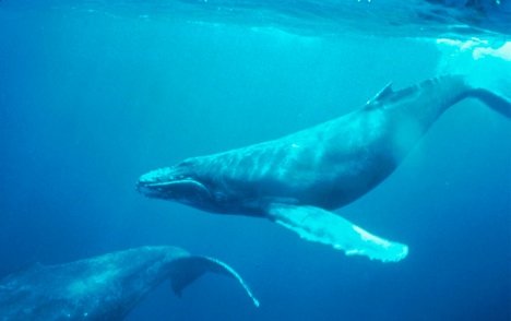
Photo via NOAA You can stream all sorts of nature sounds on your computer to keep you calm during the day — babbling brooks or rustling trees or ocean waves. But have you ever listening to whales singing live to you? A project called Listen to the Deep Ocean or LIDO , gives you that opportunity. But surprisingly, the tools used to record the song are tuned for something much more… spacey. Researchers trying to listen to neutrinos, which are emitted by distant stars, they’ve been able to pick up some extraordinary… Read the full story on TreeHugger

View original post here:
Tune In To Live Whale Songs on Your Computer

Review of Four Decades of Scientific Literature Concludes Lower Atmosphere is Warming

The troposphere, the lower part of the atmosphere closest to the Earth, is warming and this warming is broadly consistent with both theoretical expectations and climate models, according to a new scientific study that reviews the history of understanding of temperature changes and their causes in this key atmospheric layer. Scientists at NOAA, the NOAA-funded Cooperative Institute for Climate and Satellites (CICS), the United Kingdom Met Office, and the University of Reading in the United Kingdom contributed to the paper, “Tropospheric Temperature Trends: History of an Ongoing Controversy,” a review of four decades of data and scientific papers to be published today by Wiley Interdisciplinary Reviews – Climate Change, a peer-reviewed journal. The paper documents how, since the development of the very first climate models in the early 1960s, the troposphere has been projected to warm along with the Earth’s surface because of the increasing amounts of greenhouse gases in the atmosphere. This expectation has not significantly changed even with major advances in climate models and is in accord with our basic physical understanding of atmospheric processes. In the 1990s, observations did not show the troposphere, particularly in the tropics, to be warming, even though surface temperatures were rapidly warming. This lack of tropospheric warming was used by some to question both the reality of the surface warming trend and the reliability of climate models as tools. This new paper extensively reviews the relevant scientific analyses — 195 cited papers, model results and atmospheric data sets — and finds that there is no longer evidence for a fundamental discrepancy and that the troposphere is warming. “Looking at observed changes in tropospheric temperature and climate model expectations over time, the current evidence indicates that no fundamental discrepancy exists, after accounting for uncertainties in both the models and observations,” said Peter Thorne, a senior scientist with CICS in Asheville, N.C., and a senior researcher at North Carolina State University. CICS is a consortium jointly led by the University of Maryland and North Carolina State University. cont. added by: JanforGore

Riki Ott: Dispersants, Bacteria and Illness in the Gulf

“Is this the perfect storm — an exploding population of opportunistic Gram-negative bacteria (some natural, some not), millions of gallons of food (oil) for the bacteria, and a susceptible population of stressed-out people?” Excerpt: I have heard from Gulf residents and visitors who developed a rash or peeling palms from contact with Gulf water, including such activities as swimming or wading, getting splashed, handling oiled material or dead animals without gloves, and shucking crabs from the recently opened Gulf fisheries. I have also heard from people who developed the same symptoms after contact with Gulf air by wiping an oily film off their airplane's leading edges after flying over the Gulf (absorbent pad tested positive for oil) or swimming in outdoor pools, or splashing in puddles, after it rained. Outraged by the unprecedented release of oil and toxic chemicals in the Gulf, Nurse Schmidt and Mike McDowell developed a project to test Gulf rainwater for harmful chemicals. Schmidt said, “We are convinced the chemicals used in the Gulf to help disperse oil have evaporated and will eventually come down mixed with the rain.” Another clue, more like a condemnation, is that NOAA and EPA decided to use dispersants in the Gulf without considering what harm the chemicals and dispersed oil might do to people, specifically, the general public. Dr. Sylvia Earle, former chief scientist of NOAA, and other scientists, criticized the agencies' decision, in part, based on concern about harm to human health. Other scientists have also criticized the agencies' decision. Citing the National Academy of Sciences, a Texas Tech University professor testified in Congress that the chemicals break down cell walls, making organisms (including people) more susceptible to oil. The professor called the Gulf an “eco-toxicological experiment,” which is inexcusable, because OSHA has known about harm from solvent exposure since at least 1987. Don't these federal agencies talk amongst themselves — or with others? Which all brings me back to the grandmother. After talking with her, I've been reading about bacteria, and I now think the Great Gulf Experiment is going very badly for humans. One can only wonder about the rest of the ecosystem. There are two distinct types of bacteria based on the structure of their cell walls. Gram-positive bacteria have a single-membrane cell wall, while Gram-negative bacteria have a double-membrane cell wall. Methicillin-resistant Staphylococcus aureus (MRSA) bacteria are “Gram-positive,” while the oil-eating bacteria are Gram-negative. But! A component of the double-membrane cell wall structure of Gram-negative bacteria can irritate human skin, causing inflammation and activating the immune system. In other words, oil-eating bacteria, just because they are Gram-negative, can cause skin rashes. In the case of Alcanivorax borkumensis, the reaction can erupt on the skin like MRSA infections. To make things a little scarier, some of the oil-eating bacteria have been genetically modified, or otherwise bioengineered, to better eat the oil — including Alcanivorax borkumensis and some of the Pseudomonas. Oil-eating bacteria produce bio-films. According to Nurse Schmidt, studies have found that bio-films are rapidly colonized (p. 97) by other Gram-negative bacteria — including those known to infect humans. Scientists anticipated early on that the Gulf leak would cause populations of oil-eating bacteria to soar. Still, infections are not likely in healthy people. However, exposure to oil weakens a person's immune system function, as does the mental stress of dealing with disaster trauma. And then there are people who are more at risk than others to bacterial infections, especially when first challenged with oil and solvent exposure. This includes children, people with cystic fibrosis or asthma, and African Americans (who are prone to blood disorders), to name a few. Is this the perfect storm — an exploding population of opportunistic Gram-negative bacteria (some natural, some not), millions of gallons of food (oil) for the bacteria, and a susceptible population of stressed-out people? Perhaps. If the outbreak of skin rashes across the Gulf is any indication, the health care providers, media, and Congress ought to be taking a hard look at this question. Further, people ought to be connecting the dots to illnesses that surfaced in Exxon Valdez spill responders and to the illnesses occurring now in Michigan residents coping with the Enbridge oil pipeline spill. In the Gulf, Nurse Schmidt believes: This is like a major bacterial storm. It could be the reason we are seeing a variance of symptoms in different individuals. In some people, we see respiratory complications, while in others we see skin or GI symptoms. I think it is due to a multitude of colonized bacteria — which may have been triggered by BP's disaster. added by: samantha420

DJ Spooky Tells the Political Tale of Two Poles

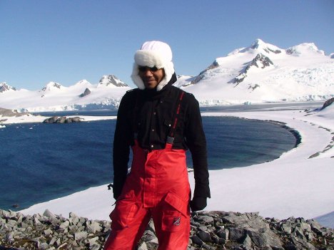
Paul D. Miller is no stranger to polar exploration. Here, DJ Spooky poses in Antarctica. Image courtesy of Cape Farewell. This guest post was written by Paul D. Miller, also known as DJ Spooky, as part of the Cape Farewell project . “How can I know what I think till I see what I say?” – E.M. Forster Here in the far North, weather conditions can change rapidly . A crystal clear day can be erased by cumulus, gray fogs drift into bays and fjords a… Read the full story on TreeHugger

More here:
DJ Spooky Tells the Political Tale of Two Poles

37 US States Set Nighttime High Temperature Records This Summer

photo: Sam Garza With January to August 2010 found to be tied for the hottest year on record by NOAA, new analysis from NRDC shows that it wasn’t just daytime temperatures that’ve been soaring. In fact, 37 states in the US set record high nighttime temperatures this summer. … Read the full story on TreeHugger

More here:
37 US States Set Nighttime High Temperature Records This Summer

Arctic sea ice shrinks to third lowest area on record

Arctic sea ice melted over the summer to cover the third smallest area on record, US researchers said Wednesday, warning global warming could leave the region ice free in the month of September 2030. Last week, at the end of the spring and summer “melt season” in the Arctic, sea ice covered 4.76 million square kilometers (1.84 million square miles), the University of Colorado's National Snow and Ice Data Center said in an annual report. “This is only the third time in the satellite record that ice extent has fallen below five million square kilometers (1.93 million square miles), and all those occurrences have been within the past four years,” the report said. A separate report by the National Oceanic and Atmospheric Administration (NOAA) found that in August, too, Arctic sea ice coverage was down sharply, covering an average of six million square kilometers (2.3 million square miles), or 22 percent below the average extent from 1979 to 2000. The August coverage was the second lowest for Arctic sea ice since records began in 1979. Only 2007 saw a smaller area of the northern sea covered in ice in August, NOAA said. The record low for Arctic sea ice cover at the end of the spring and summer “melt season” in September, was also in 2007, when ice covered just 4.13 million square kilometers (1.595 million square miles). Mark Serreze, director of the NSIDC, said climate-change skeptics might seize the fact that Arctic sea ice did not hit a record-low extent this year, but said they would be barking up the wrong tree if they claimed the shrinkage had been stopped. “Only the third lowest? It didn't set a new record? Well, right. It didn't set a new record but we're still headed down. We're not looking at any kind of recovery here,” he told AFP. In fact, Serreze said, Arctic sea ice cover is shrinking year-round, with more ice melting in the spring and summer months and less ice forming in the fall and winter. “The Arctic, like the globe as a whole, is warming up and warming up quickly, and we're starting to see the sea ice respond to that. Really, in all months, the sea ice cover is shrinking — there's an overall downward trend,” Serreze told AFP. “The extent of Arctic ice is dropping at something like 11 percent per decade — very quickly, in other words. “Our thinking is that by 2030 or so, if you went out to the Arctic on the first of September, you probably won't see any ice at all. It will look like a blue ocean, we're losing it that quickly,” he said. Losing sea ice cover in the Arctic would affect everything from the obvious, such as people who live in the far north and polar bears, to global weather patterns, said Serreze. “The Arctic acts as a sort of refrigerator of the northern hemisphere. As we lose the ice cover, we start to change the nature of that refrigerator, and what happens up there affects what happens down here in the middle latitudes,” he said. “We might have less cold outbreaks, which you might say is a good thing, but it's not such a good thing in regions that depend on snowfall for their water supply.” NOAA noted in its report that the first eight months of 2010 were in equal first place with the same period in 1998 for the warmest combined land and ocean surface temperatures on record worldwide, and the summer months were the second warmest on record globally, after 1998. added by: JanforGore